Two plates, as made
San Francisco
Bird's-eye illustration / lithograph beside true aerial photograph. Do not treat them as the same kind of evidence.
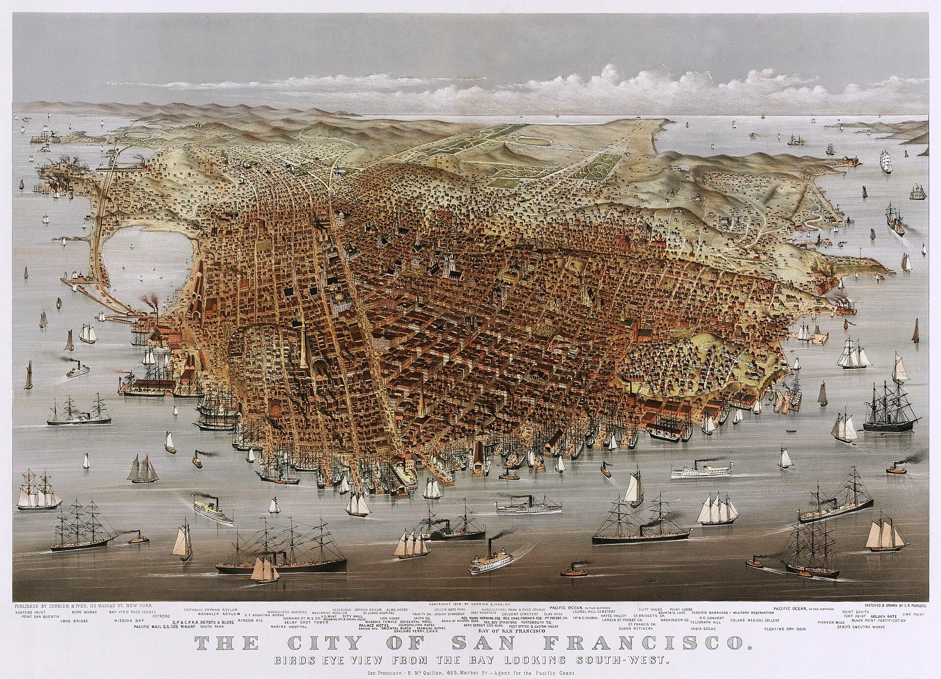
1878·San Francisco
The City of San Francisco, from the bay looking south-west
Charles R. Parsons, sketched and drawn; Currier & Ives, New York.
Bird's-eye illustration / lithograph
What this plate shows
San Francisco drawn from over the bay: wharves, shipping, the grid climbing the hills, Golden Gate to the right distance, ocean beyond. A Currier bird’s-eye of 1878 — inside 1870 ± 10. Not the 1857 Coast Survey chart, and not a photograph.
- Image type
- Bird's-eye illustration / lithograph
- Source
- Library of Congress Prints and Photographs, ppmsca.08933.
- License
- Public domain.
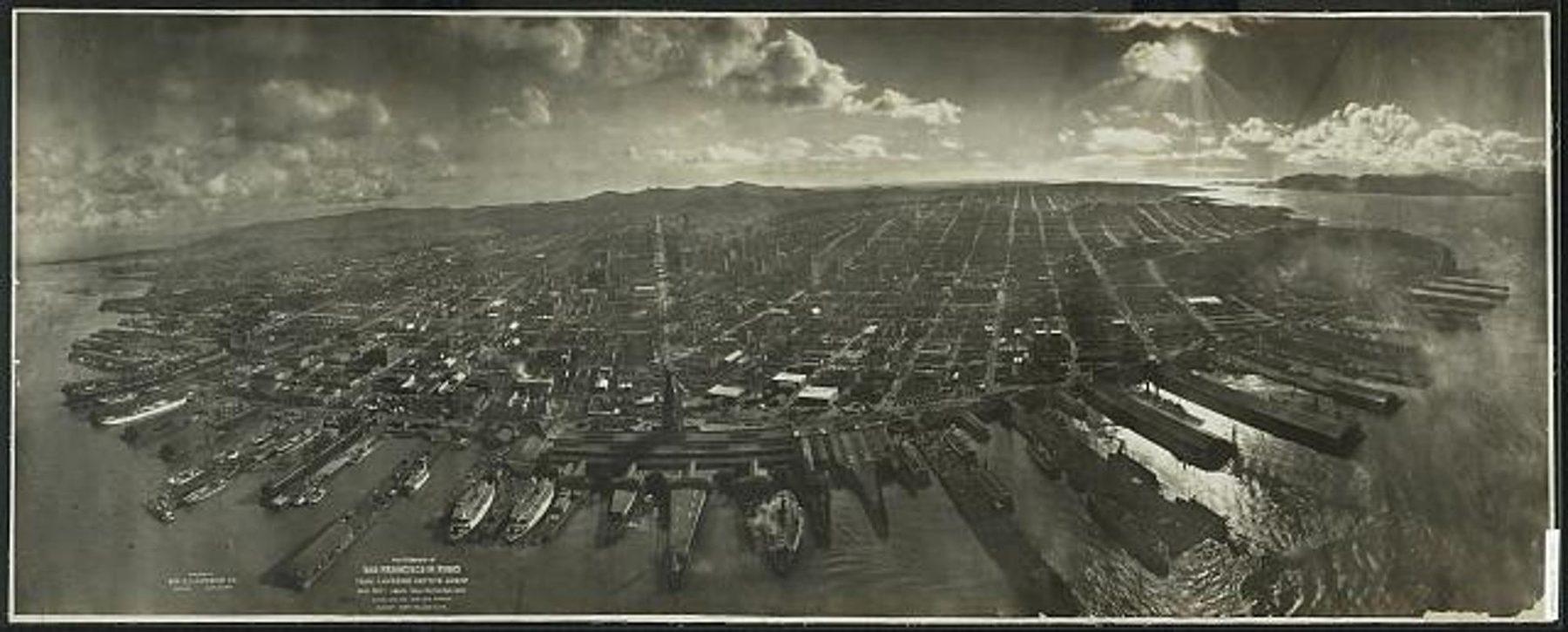
1906·San Francisco
San Francisco in ruins from a captive airship
George R. Lawrence Co. Camera suspended from kites, 28 May 1906.
True aerial photograph · Reconstructed
What this plate shows
A camera hung from kites about 2,000 feet up, 28 May 1906. The Ferry Building and the waterfront in the near field. Market Street running inland through a field of ruins. True aerial photograph — not a lithograph of the disaster. Six weeks after 18 April. The fire is out. The city as the lens found it.
- Image type
- True aerial photograph
- Structure
- San Francisco — burnt district after 18 April 1906
- Region
- North America
- Present status
- Reconstructed — The city was rebuilt. This plate is the event: six weeks after the earthquake and fire, from the air.
- Source
- Library of Congress Prints and Photographs, LC-DIG-ppmsca-07823.
- License
- Public domain (published 1906).