Research branch · dated evidence

Maps

A chronological stream of original historical maps. Dates are primary here. Do not redraw an old map to make it fit The Living Realm. Show the original, record what it depicts, then set it beside the next one.

Seven period originals. Two later schematics, labeled as such. Nothing is corrected silently — Disturnell’s El Paso error stays on Disturnell; island California stays an island until a later plate draws a peninsula.

01 / 10

Earliest America

The name America is printed. The west coast is not yet a measured California.
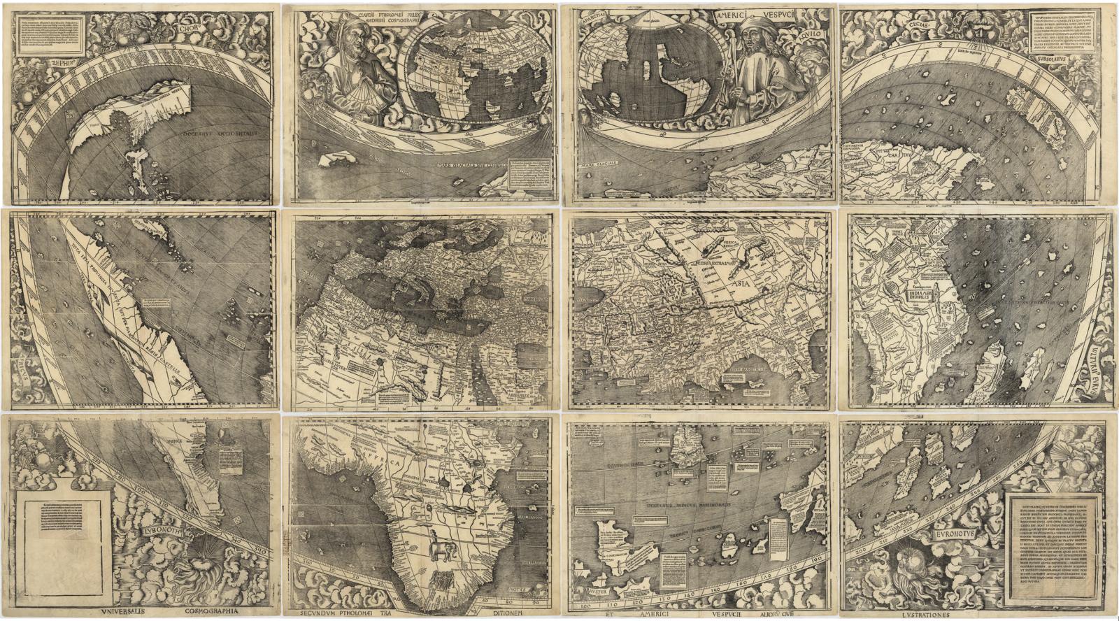
Universalis Cosmographia, 1507. Martin Waldseemüller.

1507

Universalis Cosmographia

Martin Waldseemüller

Period original

What this plate depicts

A twelve-sheet world map. The Atlantic is open. A separate western landmass is drawn apart from Asia. The name America appears on this map — the first printed use of the name. The Pacific is not yet a surveyed ocean. North America’s west coast is not a measured California; it is an unfinished edge of a newly named world.

Source
Library of Congress, Geography and Map Division (the 1507 world map).
License
Public domain (published 1507).

All plates

Year order. Open a plate, read what it depicts, then compare it with the next original.

  1. 1507Universalis CosmographiaOriginal
  2. c. 1650California as an islandOriginal
  3. 1755Map of the British and French Dominions in North AmericaOriginal
  4. 1755A New and Accurate Map of North AmericaOriginal
  5. 1847Mapa de los Estados Unidos de MéjicoOriginal
  6. 1848 outcome (modern schematic)Mexican CessionSchematic
  7. 1857U.S. Coast Survey — San Francisco Bay and the California coastOriginal
  8. 19th c. posts (modern schematic)Russian America — named settlementsSchematic
  9. 1877Distribution of Indian tribes in CaliforniaOriginal