02 / 10
Chronological progression
Read the originals in date order. Each plate is evidence of what was drawable that year.
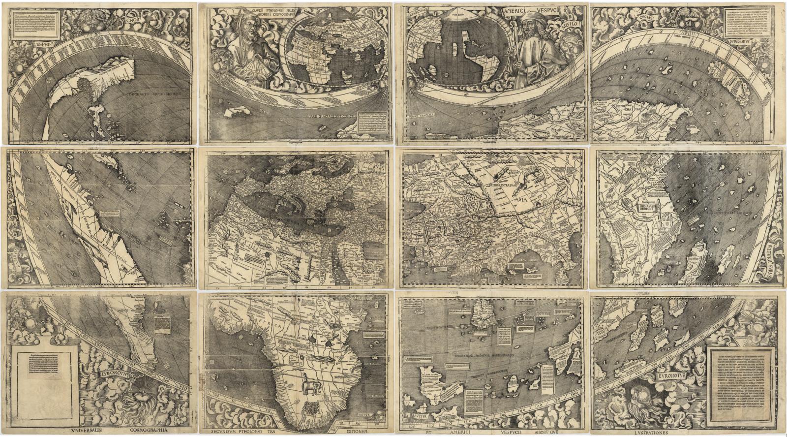
1507
Universalis Cosmographia
Martin Waldseemüller
Period original
A twelve-sheet world map. The Atlantic is open. A separate western landmass is drawn apart from Asia. The name America appears on this map — the first printed use of the name. The Pacific is not yet a surveyed ocean. North America’s west coast is not a measured California; it is an unfinished edge of a newly named world.
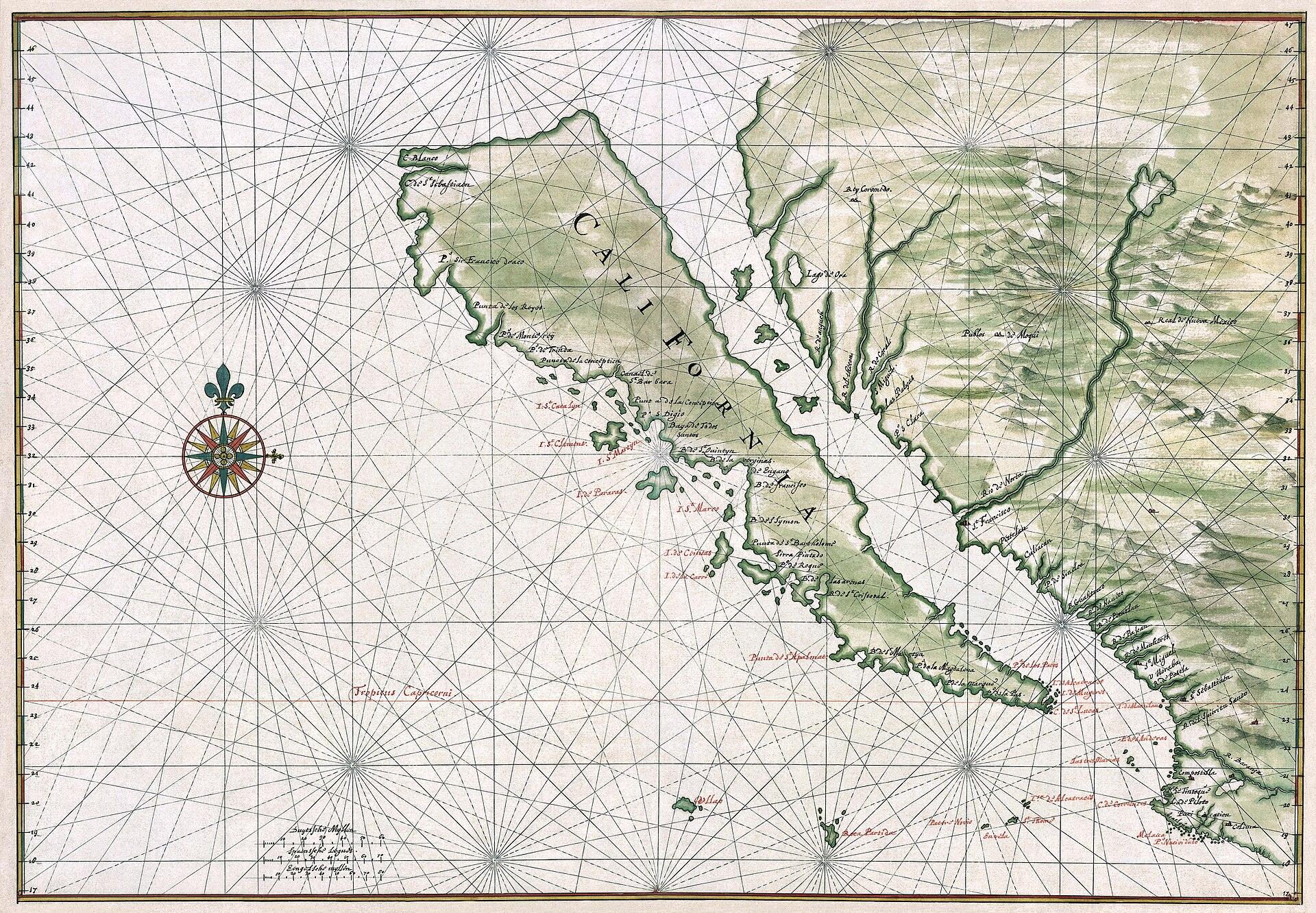
c. 1650
California as an island
Joan Vinckeboons (Johannes Vingboons)
Period original
California is drawn as a large, carrot-shaped island off western North America, separated by a gulf labeled as a sea. Coastal names, bays, and islands are written on the island’s Pacific face. The mainland to the east is a separate mass. This is what the plate actually claims: an insular California, not a peninsula. The depiction circulated on European maps for about a century after Spanish coastal reconnaissance had already found Baja attached.
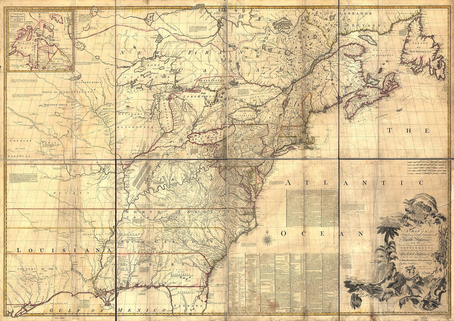
1755
Map of the British and French Dominions in North America
John Mitchell; engraved by Thomas Kitchin
Period original
A claims map of eastern North America: British and French dominions, roads, distances, limits, and extent of settlements, inscribed to the Earl of Halifax and the Lords Commissioners for Trade and Plantations. Native nations appear as names inside imperial geography. The west coast of the continent is outside this sheet’s job. This is colonial jurisdiction as London printed it in 1755, not a Native-authored map of nations.

1755
A New and Accurate Map of North America
John Huske; Thomas Kitchin sculpt.
Period original
The title states the job: to correct “the errors of all preceding British, French and Dutch maps respecting the rights of Great Britain, France & Spain, & the limits of each of His Majesty’s provinces.” Coverage runs from Newfoundland toward Florida, with a Hudson Bay inset. Pennsylvania’s drawn limits are part of the argument. This plate is a dispute about European rights, drawn as geography.
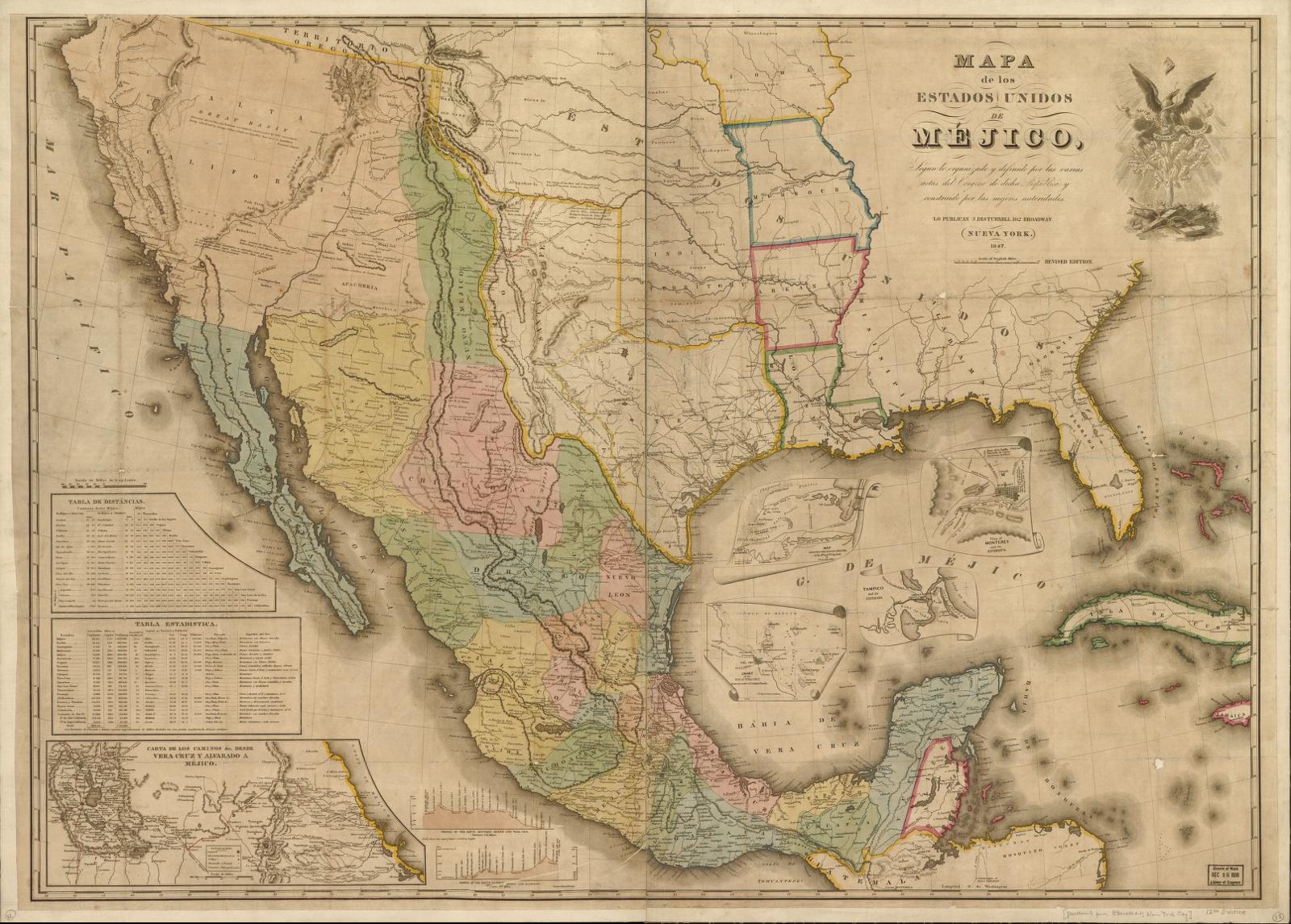
1847
Mapa de los Estados Unidos de Méjico
John Disturnell (after White, Gallaher & White, 1828)
Period original
Mexico as Disturnell issued it in 1847, including Texas and Alta California. Upper California is on the sheet as Mexican territory at the moment the war map becomes a treaty map. Later boundary commissions found Disturnell’s El Paso too far north and east of the ground. Record the plate as printed: a New York publisher’s Mexico, attached to a peace, with errors that then had to be surveyed out. Do not silently correct the El Paso error on this image.
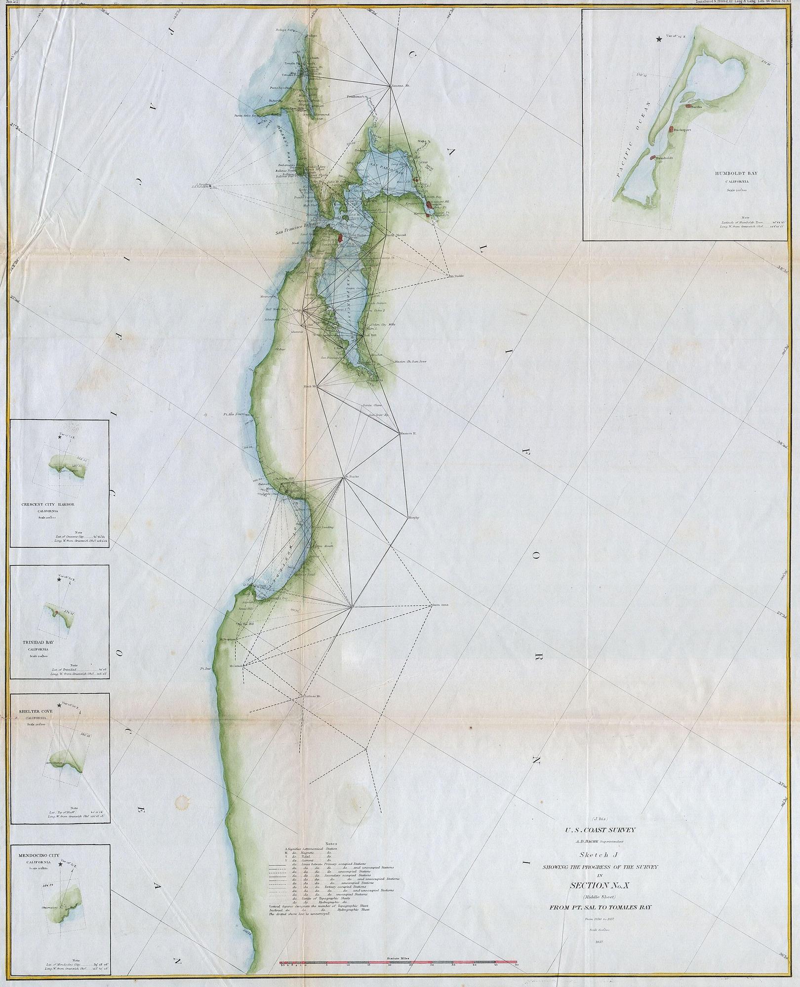
1857
U.S. Coast Survey — San Francisco Bay and the California coast
U.S. Coast Survey, under A. D. Bache
Period original
A surveyed California coast: triangulation, shoreline, San Francisco Bay, depth of survey notes. The peninsula is attached to the mainland. The bay is a measured harbor, not a gulf that makes California an island. Issued about eight years after the gold-rush population jump; related city sheets of this survey generation show San Francisco still hugging the waterfront, with Yerba Buena Cove already in the process of being filled. The name on the American survey is San Francisco, not Yerba Buena (the pueblo was renamed in 1847).
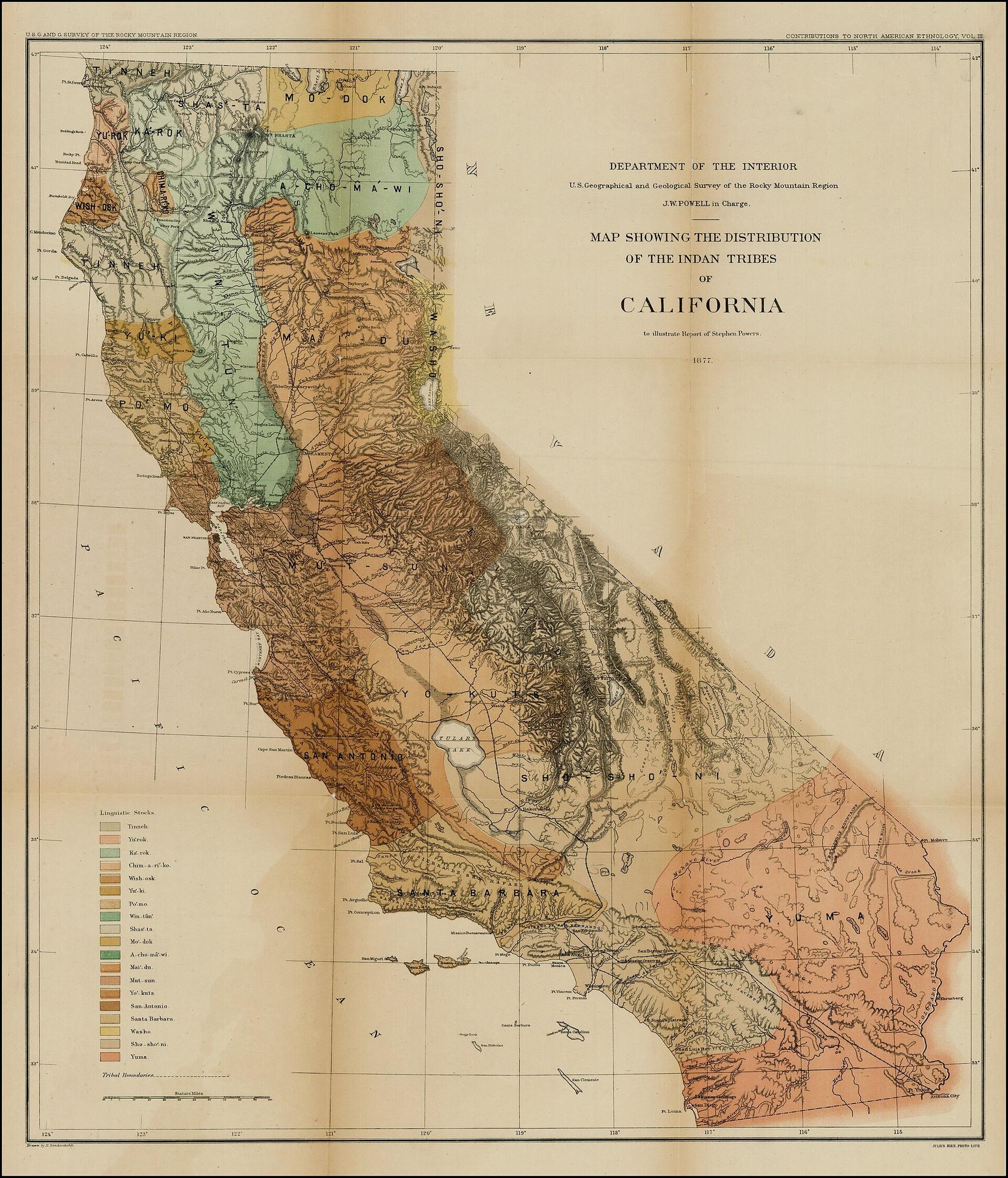
1877
Distribution of Indian tribes in California
John Wesley Powell (U.S. Geographical and Geological Survey of the Rocky Mountain Region)
Period original
Powell’s colored patches of tribal names across California, with a language-family key (Yuman, Shoshonean, Mariposan, Moquelumnan, Kulanapan, and others as he grouped them). Coast, valley, mountain, and desert are all assigned. This is a U.S. ethnologist’s 1877 compilation — a period document of how a federal survey mapped nations after conquest. It is not a Native-authored map, not a map of 1600, and not a map of reservation law. Record Powell’s lines; do not promote them into the nations’ own cartography.