Two plates, as printed
1755 beside 1755
Nothing is redrawn. Each column is what that sheet actually shows. Read both records before deciding they rhyme.
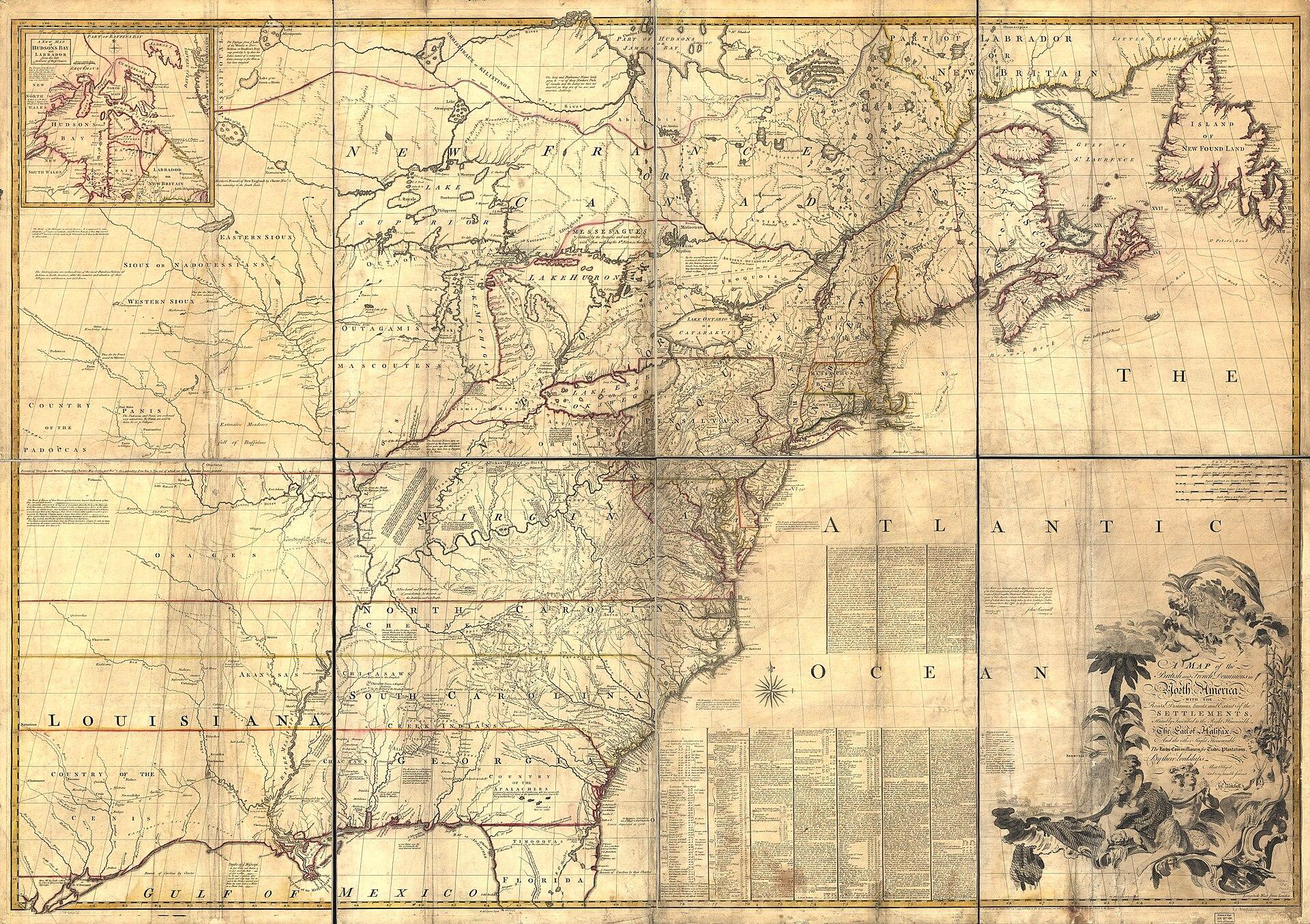
1755
Map of the British and French Dominions in North America
John Mitchell; engraved by Thomas Kitchin
Period original
What this plate depicts
A claims map of eastern North America: British and French dominions, roads, distances, limits, and extent of settlements, inscribed to the Earl of Halifax and the Lords Commissioners for Trade and Plantations. Native nations appear as names inside imperial geography. The west coast of the continent is outside this sheet’s job. This is colonial jurisdiction as London printed it in 1755, not a Native-authored map of nations.
- Source
- Library of Congress; published for Jefferys and Faden, London, 13 February 1755.
- License
- Public domain.

1755
A New and Accurate Map of North America
John Huske; Thomas Kitchin sculpt.
Period original
What this plate depicts
The title states the job: to correct “the errors of all preceding British, French and Dutch maps respecting the rights of Great Britain, France & Spain, & the limits of each of His Majesty’s provinces.” Coverage runs from Newfoundland toward Florida, with a Hudson Bay inset. Pennsylvania’s drawn limits are part of the argument. This plate is a dispute about European rights, drawn as geography.
- Source
- Library of Congress, from Huske’s The Present State of North America (also issued 1760).
- License
- Public domain.