10 / 10
Modern boundaries
A later schematic of the 1848 outcome. Compare it with Disturnell, which is the period map.
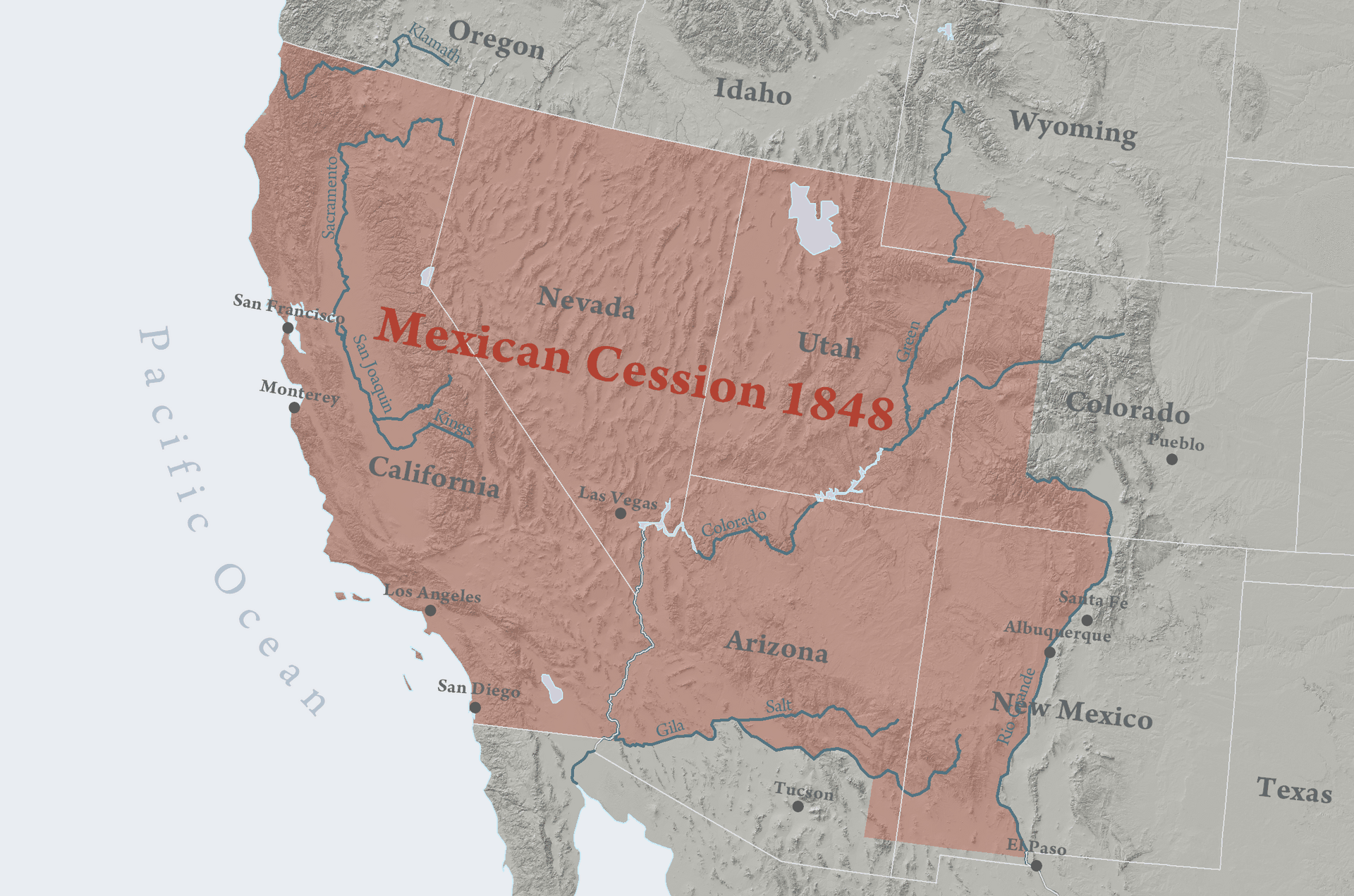
1848 outcome (modern schematic)
Mexican Cession
Modern teaching schematic of the 1848 territorial outcome.
Modern schematic · not a period original
What this plate depicts
A later colored diagram of what the 1848 settlement moved: Mexican Cession in one tint, Texas annexation in another, Gadsden Purchase (1853) as a southern strip, Oregon Country, and the existing United States. State lines inside the cession are anachronistic on a “1848” reading. Record the diagram as a modern summary of outcome, then go back to Disturnell for the plate that was actually clipped to the treaty. Do not treat this PNG as a surveyed boundary.
- Source
- Wikimedia Commons “Mexican Cession.png” — a later diagram, not an 1848 survey.
- License
- Schematic. The period treaty map in this atlas is Disturnell 1847.
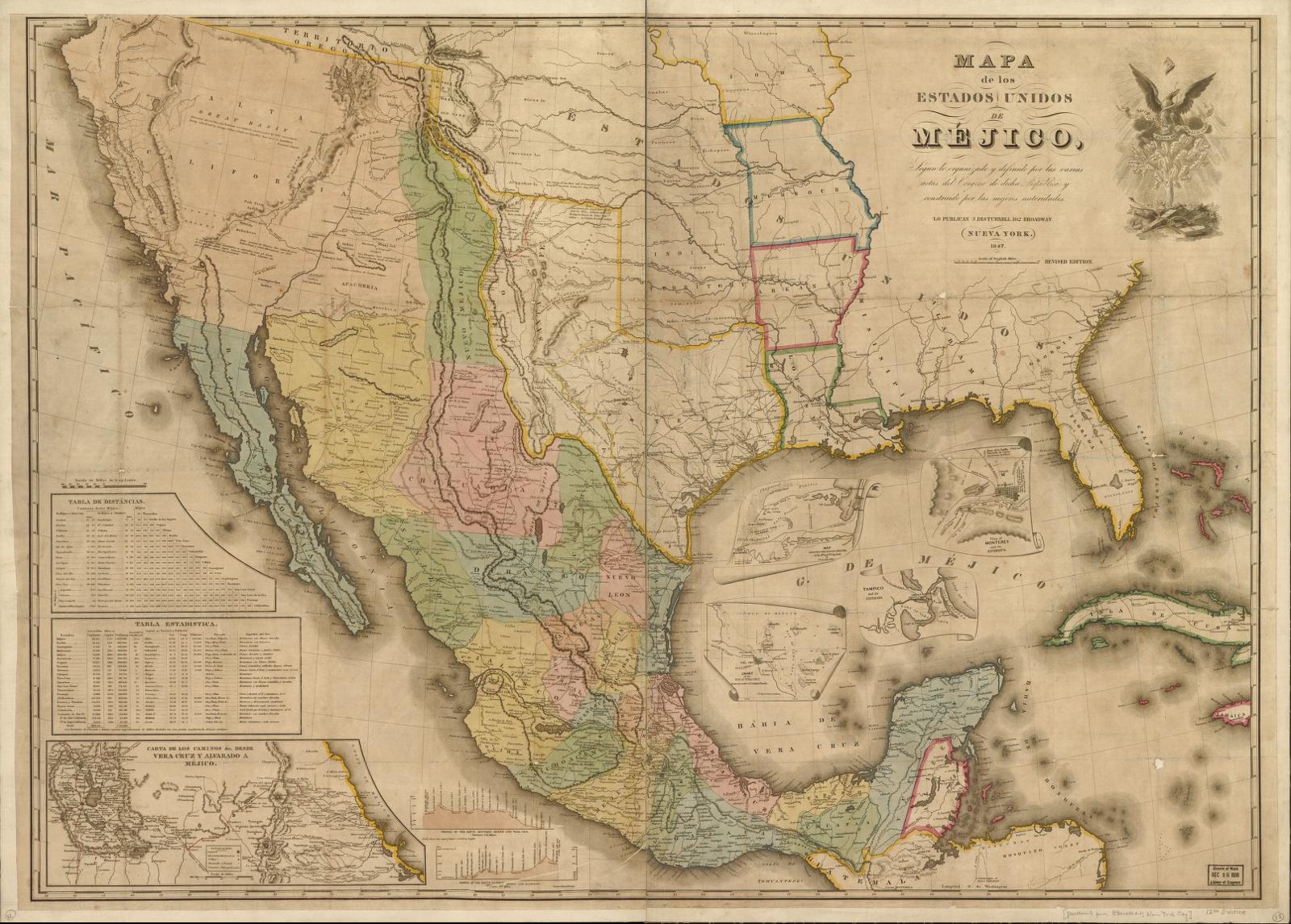
1847
Mapa de los Estados Unidos de Méjico
John Disturnell (after White, Gallaher & White, 1828)
Period original
What this plate depicts
Mexico as Disturnell issued it in 1847, including Texas and Alta California. Upper California is on the sheet as Mexican territory at the moment the war map becomes a treaty map. Later boundary commissions found Disturnell’s El Paso too far north and east of the ground. Record the plate as printed: a New York publisher’s Mexico, attached to a peace, with errors that then had to be surveyed out. Do not silently correct the El Paso error on this image.
- Source
- University of Texas at Arlington Libraries Special Collections; the 1847 edition used in Treaty of Guadalupe Hidalgo copies.
- License
- Public domain.