1857
U.S. Coast Survey — San Francisco Bay and the California coast
U.S. Coast Survey, under A. D. Bache
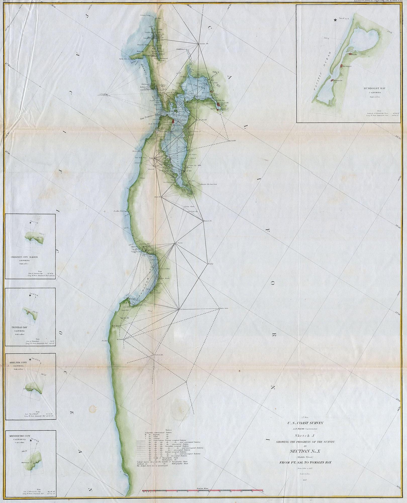
1857
U.S. Coast Survey — San Francisco Bay and the California coast
U.S. Coast Survey, under A. D. Bache
Period original
What this plate depicts
A surveyed California coast: triangulation, shoreline, San Francisco Bay, depth of survey notes. The peninsula is attached to the mainland. The bay is a measured harbor, not a gulf that makes California an island. Issued about eight years after the gold-rush population jump; related city sheets of this survey generation show San Francisco still hugging the waterfront, with Yerba Buena Cove already in the process of being filled. The name on the American survey is San Francisco, not Yerba Buena (the pueblo was renamed in 1847).
- Source
- Geographicus / Wikimedia; Coast Survey sketch of Section X, Point Sal to Tomales Bay, 1857.
- License
- Public domain (U.S. government work).
Compare with the next
Record this sheet first. Then set it beside another plate. Nothing is redrawn to make them agree.
Chapters where this plate appears
- 02Chronological progressionRead the originals in date order. Each plate is evidence of what was drawable that year.
- 08San Francisco anomalyIsland California on a c. 1650 manuscript; a surveyed peninsula and bay in 1857. The anomaly is in the plates. Nothing is redrawn to fit a thesis.
- 09Settlement expansionCoast Survey after the gold rush: a measured harbor, a city on the cove, a new name.