1877
Distribution of Indian tribes in California
John Wesley Powell (U.S. Geographical and Geological Survey of the Rocky Mountain Region)
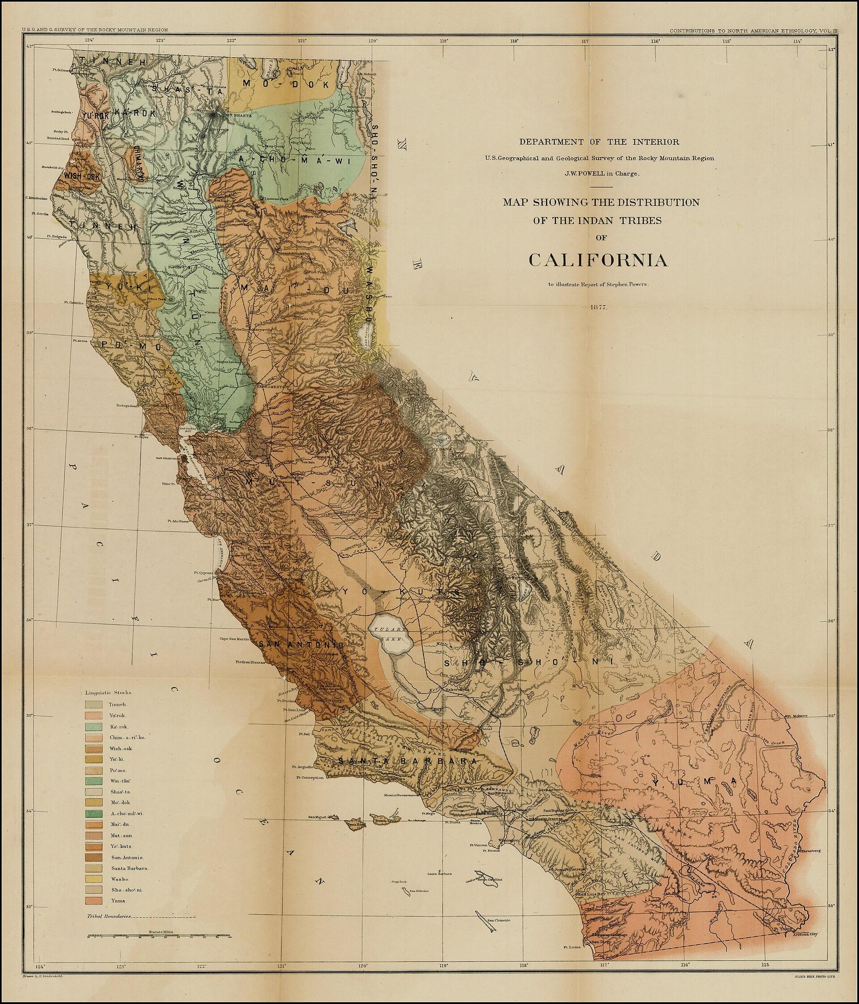
1877
Distribution of Indian tribes in California
John Wesley Powell (U.S. Geographical and Geological Survey of the Rocky Mountain Region)
Period original
What this plate depicts
Powell’s colored patches of tribal names across California, with a language-family key (Yuman, Shoshonean, Mariposan, Moquelumnan, Kulanapan, and others as he grouped them). Coast, valley, mountain, and desert are all assigned. This is a U.S. ethnologist’s 1877 compilation — a period document of how a federal survey mapped nations after conquest. It is not a Native-authored map, not a map of 1600, and not a map of reservation law. Record Powell’s lines; do not promote them into the nations’ own cartography.
- Source
- Wikimedia Commons scan of Powell’s 1877 distribution map of California tribes.
- License
- Public domain (U.S. government work, 1877).
Compare with the next
Record this sheet first. Then set it beside another plate. Nothing is redrawn to make them agree.