c. 1865London
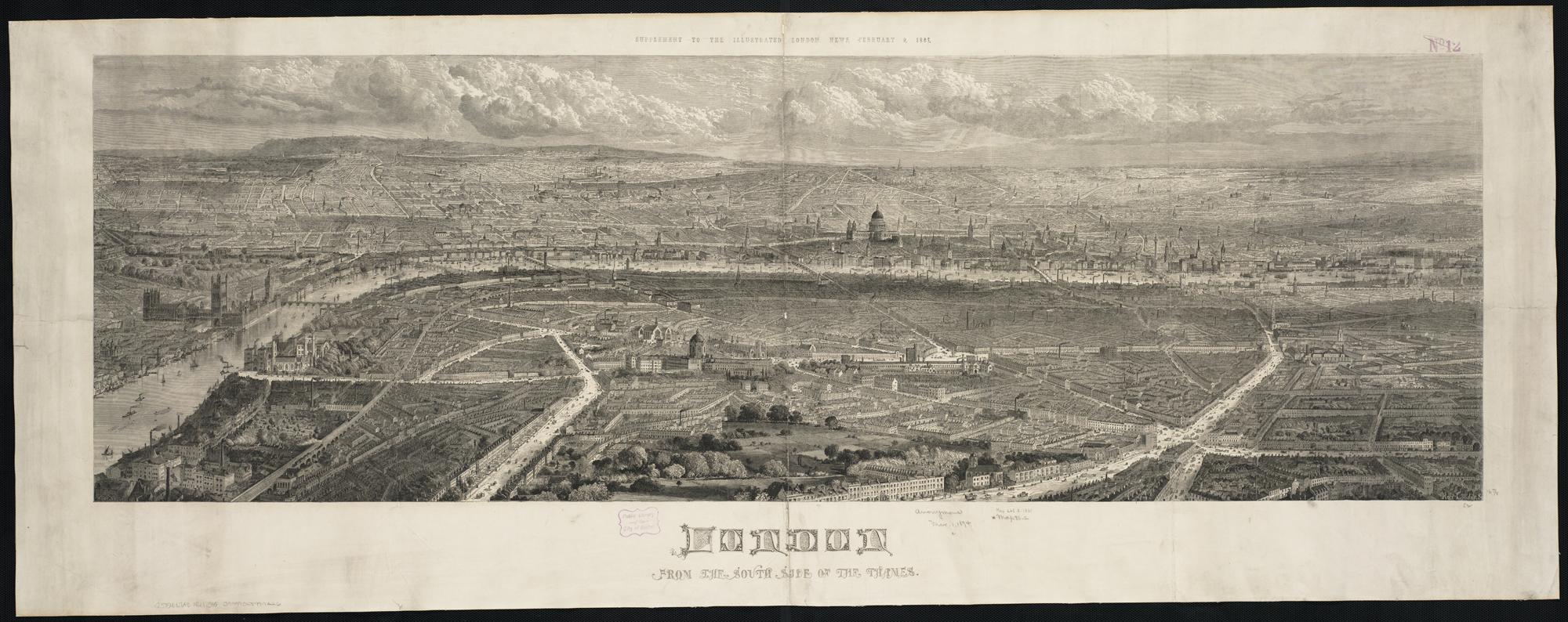
London from the south side of the Thames
Printed panorama (Leventhal Map Center / Wikimedia scan).
Bird's-eye illustration / lithograph
c. 1865·London
London from the south side of the Thames
Printed panorama (Leventhal Map Center / Wikimedia scan).
Bird's-eye illustration / lithograph
What this plate shows
A drawn strip of London seen from the south bank: river, bridges, dome, a continuous skyline. An illustration of the whole, not a single exposure. Set it beside the rooftop photograph before deciding they show the same city the same way.
- Image type
- Bird's-eye illustration / lithograph
- Source
- Norman B. Leventhal Map Center collection, circulated via Wikimedia Commons.
- License
- Public domain.
Same city, two kinds
A drawn panorama from the south bank beside a photograph from the roofs. Same city, two kinds.