Two plates, as printed
c. 1650 beside 1857
Nothing is redrawn. Each column is what that sheet actually shows. Read both records before deciding they rhyme.
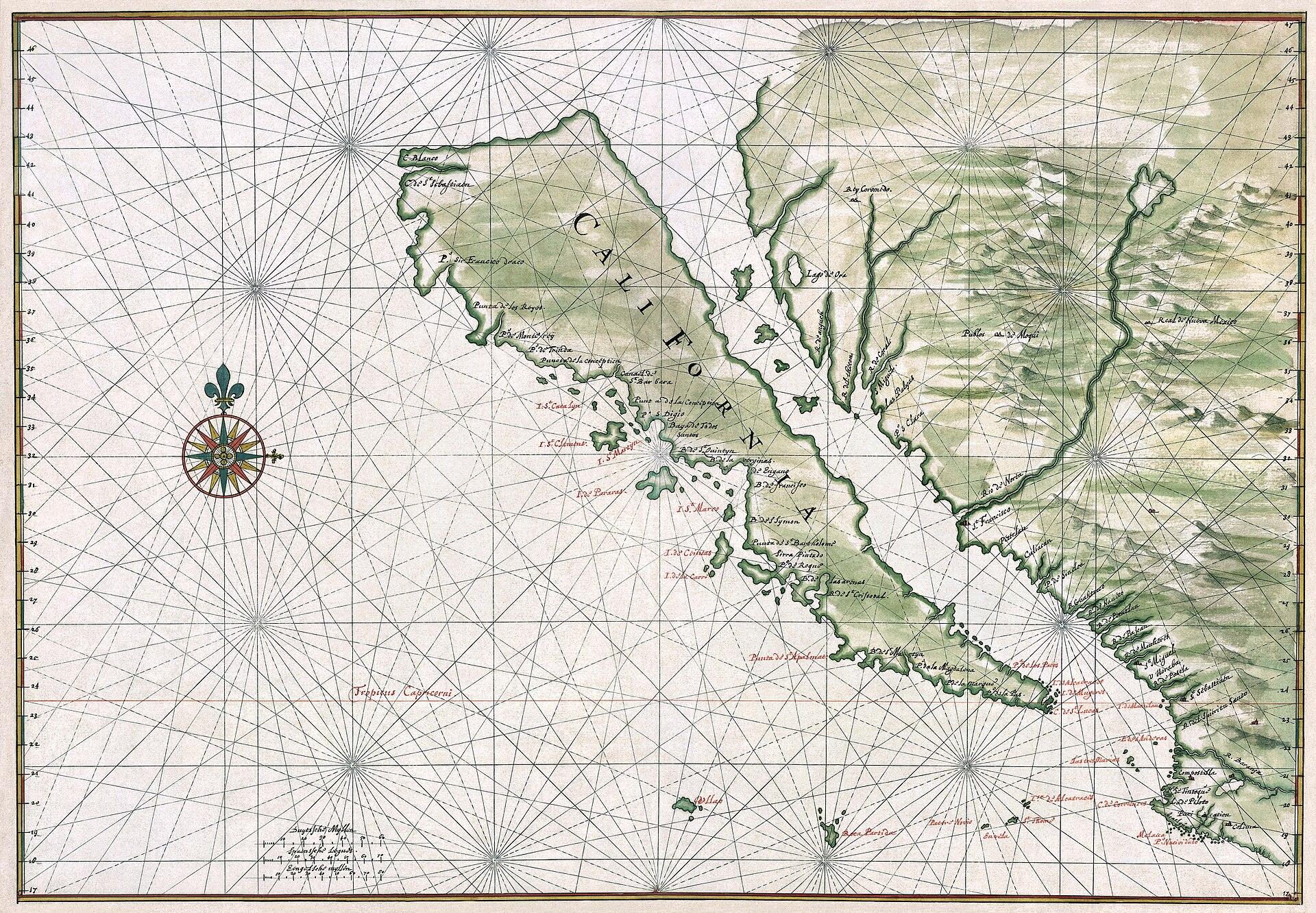
c. 1650
California as an island
Joan Vinckeboons (Johannes Vingboons)
Period original
What this plate depicts
California is drawn as a large, carrot-shaped island off western North America, separated by a gulf labeled as a sea. Coastal names, bays, and islands are written on the island’s Pacific face. The mainland to the east is a separate mass. This is what the plate actually claims: an insular California, not a peninsula. The depiction circulated on European maps for about a century after Spanish coastal reconnaissance had already found Baja attached.
- Source
- Library of Congress; Wikimedia Commons scan of the c. 1650 manuscript.
- License
- Public domain.
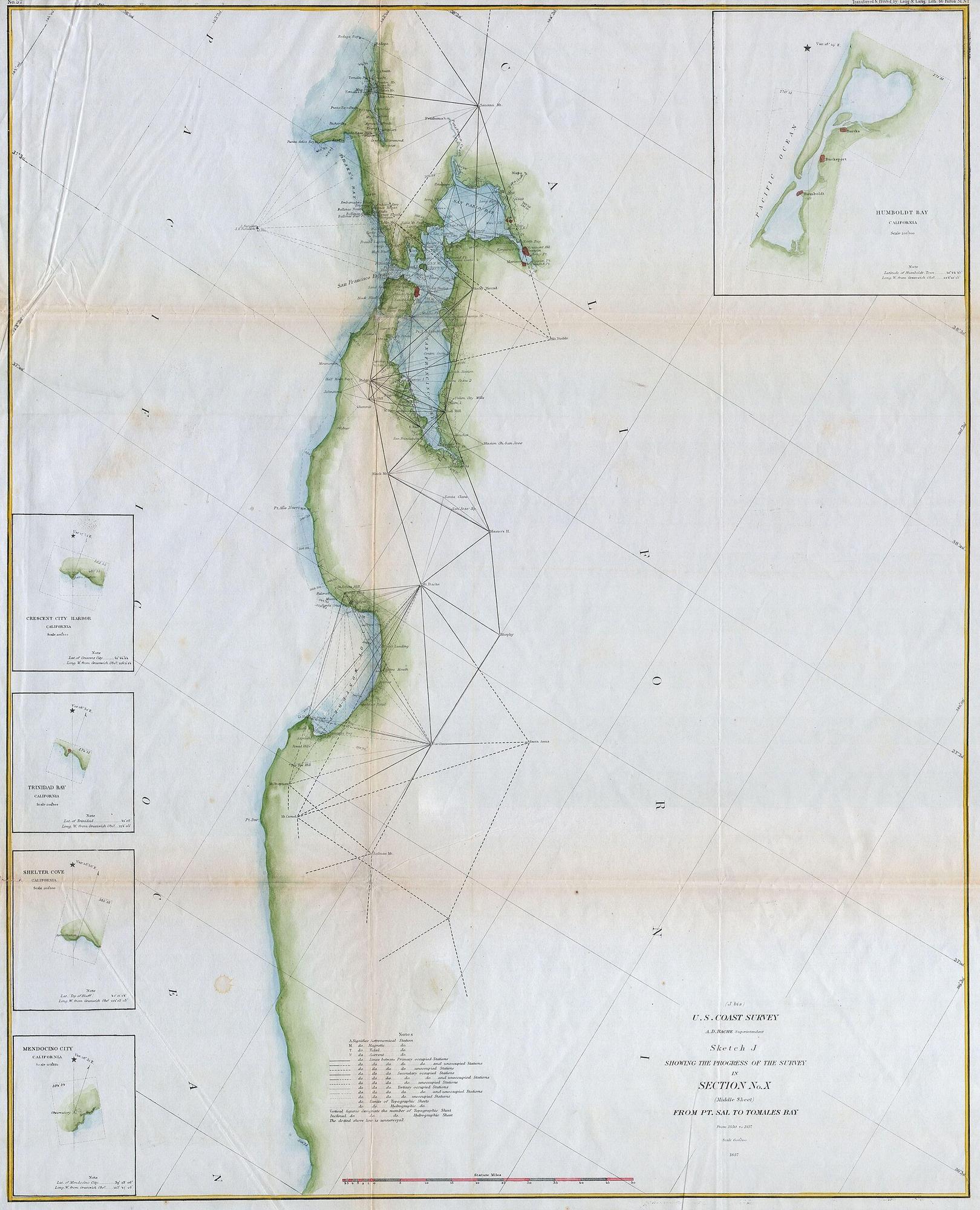
1857
U.S. Coast Survey — San Francisco Bay and the California coast
U.S. Coast Survey, under A. D. Bache
Period original
What this plate depicts
A surveyed California coast: triangulation, shoreline, San Francisco Bay, depth of survey notes. The peninsula is attached to the mainland. The bay is a measured harbor, not a gulf that makes California an island. Issued about eight years after the gold-rush population jump; related city sheets of this survey generation show San Francisco still hugging the waterfront, with Yerba Buena Cove already in the process of being filled. The name on the American survey is San Francisco, not Yerba Buena (the pueblo was renamed in 1847).
- Source
- Geographicus / Wikimedia; Coast Survey sketch of Section X, Point Sal to Tomales Bay, 1857.
- License
- Public domain (U.S. government work).